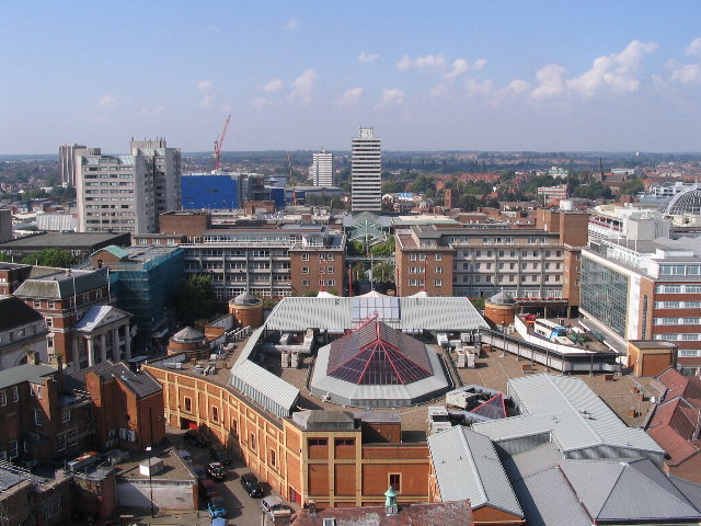
Fichier:Broadgate and Precincts - geograph.org.uk - 554599.jpg
Broadgate_and_Precincts_-_geograph.org.uk_-_554599.jpg (640 × 480 pixels, taille du fichier : 96 kio, type MIME : image/jpeg)
Historique du fichier
Cliquer sur une date et heure pour voir le fichier tel qu'il était à ce moment-là.
| Date et heure | Vignette | Dimensions | Utilisateur | Commentaire | |
|---|---|---|---|---|---|
| actuel | 6 février 2011 à 02:26 |  | 640 × 480 (96 kio) | GeographBot | == {{int:filedesc}} == {{Information |description={{en|1=Broadgate and Precincts Taken from the tower of the old cathedral church of St. Michael, looking westwards down the line of the Upper and Lower Precinct shopping areas towards Mercia House[1], the t |
Utilisation du fichier
Les 3 pages suivantes utilisent ce fichier :
Usage global du fichier
Les autres wikis suivants utilisent ce fichier :
- Utilisation sur af.wikipedia.org
- Utilisation sur an.wikipedia.org
- Utilisation sur ar.wikipedia.org
- Utilisation sur arz.wikipedia.org
- Utilisation sur ast.wikipedia.org
- Utilisation sur azb.wikipedia.org
- Utilisation sur az.wikipedia.org
- Utilisation sur be-tarask.wikipedia.org
- Utilisation sur be.wikipedia.org
- Utilisation sur ca.wikipedia.org
- Utilisation sur ceb.wikipedia.org
- Utilisation sur cs.wikipedia.org
- Utilisation sur cy.wikipedia.org
- Utilisation sur da.wikipedia.org
- Utilisation sur de.wikipedia.org
- Utilisation sur de.wikivoyage.org
- Utilisation sur diq.wikipedia.org
- Utilisation sur el.wikipedia.org
- Utilisation sur en.wikipedia.org
- Utilisation sur en.wikivoyage.org
- Utilisation sur eo.wikipedia.org
- Utilisation sur es.wikipedia.org
- Utilisation sur eu.wikipedia.org
- Utilisation sur frr.wikipedia.org
- Utilisation sur fr.wikipedia.org
- Utilisation sur fy.wikipedia.org
- Utilisation sur ga.wikipedia.org
- Utilisation sur gl.wikipedia.org
- Utilisation sur he.wikivoyage.org
- Utilisation sur hy.wikipedia.org
- Utilisation sur ku.wikipedia.org
- Utilisation sur lld.wikipedia.org
- Utilisation sur lv.wikipedia.org
- Utilisation sur mdf.wikipedia.org
- Utilisation sur mzn.wikipedia.org
- Utilisation sur nn.wikipedia.org
- Utilisation sur no.wikipedia.org
- Utilisation sur os.wikipedia.org
- Utilisation sur pl.wikipedia.org
- Utilisation sur pl.wikivoyage.org
- Utilisation sur pnb.wikipedia.org
- Utilisation sur ro.wikipedia.org
- Utilisation sur ru.wikinews.org
- Utilisation sur sco.wikipedia.org
- Utilisation sur sr.wikipedia.org
Voir davantage sur l’utilisation globale de ce fichier.

